Guides & Resources
Two guidebooks, “Trails of the Wild Selkirks” and “Trails of the Wild Cabinets,” by Dennis Nicholls, provide trail descriptions for trails in both the Selkirk and Cabinet Mountains surrounding Sandpoint.
The guidebook “Legendary Lake Pend Oreille” offers 30 trail descriptions for trails that lead to or have great views of Lake Pend Oreille.
These guidebooks and more are available from Keokee Books or at local book, bike, and outdoor stores around Sandpoint and the Northwest.
Also, check these stories on hiking from past editions of Sandpoint Magazine:
* Hiking the Southern Selkirks with an Artist
* Easy Hiking – Easy to get to, that is, but not necessarily easy to do
* Get Out There – 10 adventures within an hour of Sandpoint
* Wilder Walks – Miraculous summer: Seven months in the Selkirks
* Wild Walks – Lake hikes in the Cabinets
* Waterfall Hikes – High steppin’ to waterfalls
* A ‘5-Bear Day’ in the Cabinets
* To Sample the Beauty, Take a Hike
* Finding Treasure on the Great Divide
For trails that are around Lake Pend Oreille or have fantastic views of the lake, check the Lake Walks page.
For Forest Service trails listed by ranger district with links to trail descriptions, go to the Idaho Panhandle National Forest Trails page.
Here are six trails easily reached from Sandpoint:
Evans Landing Trail
Evans Landing Trail leads 2 miles down to a beach at the landing on the west side of Lake Pend Oreille. A multitude of switchbacks make for a gentle grade, beginning at the top of Kreiger Creek on Trail No. 64. The slope becomes extremely steep closer to the lake, however. The remains of an old cabin are tucked away behind some ponderosa pine trees, and nearby is a picnic table on the edge of the stony beach, plus a vault toilet. Access is 17 miles south of Sandpoint on U.S. Highway 95 via the southern end of Blacktail Road. Follow it east 2.6 miles to Little Blacktail Road, turn east again and go another 2.6 miles past one trail sign to East Ridge Road where a second trail sign indicates the way to the trailhead. Take a right on East Ridge Road, go a half mile and turn left onto a short spur road and the parking area.
Gold Hill Trail

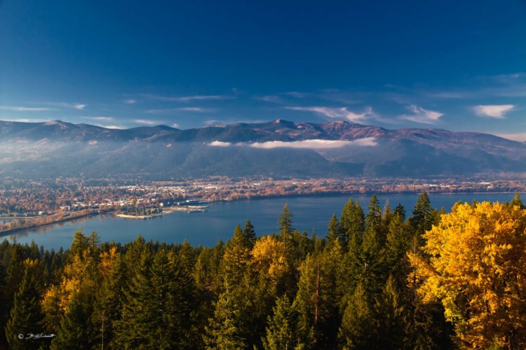
Photo source: Bill Schaudt
The Gold Hill Trail is one of the most popular for local hikers and mountain bikers, a 3.7-mile track that can be moderate or strenuous – depending on whether you hike or ride it up or down, or as most do, both ways.
If you are ready to enjoy all the adventure and scenic outdoor recreation that the Sandpoint, Idaho area offers, this is one trail that you don’t want to miss for a terrific hike or bike ride.
The trail leads uphill through a forested setting to panoramic northwest-facing views of Sandpoint across Lake Pend Oreille with the Selkirk Mountains behind. There are several scenic overlooks along the way with benches for a short rest.
If you’re hiking, beware that many mountain bikers do this as an out-and-back, starting at the trailhead for the uphill singletrack. However, some ride an extended route at the top of Trail 3, to include Gold Mountain and forest roads. Keep an eye and ear out for bikers as you enjoy the views.
This is hiking at its best in the Pacific Northwest!
Getting There
Most start at the trailhead on Bottle Bay Road, about 8 miles south of Sandpoint; you can navigate to the trailhead parking with Google maps. Note that parking is extremely limited. Expect the lot to be full on the weekends; parking on Bottle Bay Road is not allowed. It is possible to circle around by forest roads and access the trail up near the viewpoints, however please be cautious of taking the wrong turn and ending up on private property.
Click for USFS trail map and details: Forest Service Gold Hill Trail No. 3.
Click for extended route details: MTB Project Gold Hill Trail No. 3.
Maiden Rock Trail
Maiden Creek Trail is a steep 2-mile trail that leads down Maiden Rock, a prominent geologic feature, and a Forest Service recreation site on Lake Pend Oreille. The trail to this magical spot on the lake’s western shore is fairly short, though quite steep as you get closer to the lake. It cuts through a dense forest in a deep notch between two mountains to where the waters of Maiden Creek first gurgle to the surface. It follows the creek steeply downhill to the lake. There are campsites, picnic tables, and a pit toilet available at the lakeside.
Getting There
Access is 11 miles south of Sandpoint on U.S. Highway 95 via the north end of Blacktail Road. Go 1.5 miles to Butler Creek Road No. 230. Turn left and travel three miles to the trailhead. There is also boat access via the lake, but there are no docks available.
Mickinnick Trail
Easily accessible from Sandpoint to Sandpoint, the Mickinnick is a challenging trail that rises more than 2,000 feet in its 3.5-mile length (meaning, a round-trip hike is 7 miles). But the workout is certainly worth it, affording splendid views as you climb up through big granite features amid open forests and spring-summer wildflowers. On warm summer days, the east-facing aspect of the trail makes it more user-friendly in the afternoon. The trail ends on a rocky knob commanding a view of Sandpoint, the Long Bridge, the Cabinet Mountains and Lake Pend Oreille.
Getting There
Use Google maps to navigate to the trailhead parking, at roughly 400 Woodland Drive, or click to the Forest Service map and elevation profile.
Mineral Point Interpretive Trail

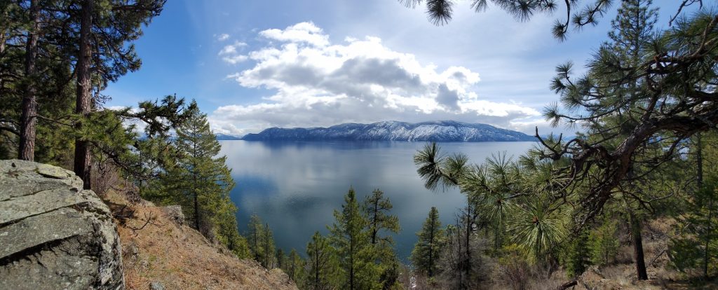
Here’s an easy hike that provides a starting and ending spot in Garfield Bay along Lake Pend Oreille, with a swimming beach, marina and dining opportunities at the Captn’s Table, or a stop during the ride at the fine, undeveloped Green Bay cobblestone beach. This route includes about 2.1 miles of single track on Mineral Point trail itself, but can be extended by starting from Garfield Bay, with outstanding views of Lake Pend Oreille and the Green Monarchs.
Getting There
From Sandpoint, drive six miles south on Highway 95 to Sagle, and turn east onto Sagle Road. Continue a bit more than six miles to the junction where Garfield Bay Road forks to the right and continue another roughly two miles to the waterfront village of Garfield Bay. From Garfield Bay Road, find Green Bay Cutoff Road, which proceeds north. The cutoff will quickly become a gravel road; go about .4 mile and turn right onto the Mineral Point Road No. 532 (next to the red firehouse) and drive 2.2 miles on Road 532, before turning right for 0.3 miles to reach the Mineral Point trailhead. The trail will then take you on 2.1 miles of single track high along the lakeshore, dropping down to the Green Bay campground and beach, a great place to stop for a swim or to hang along the lake.
Schweitzer Biking and Hiking
Looking for a fun and adventurous way to take in the fresh mountain air and beautiful views? Whether you’re a hiker or biker, Schweitzer Mountain Resort offers more than 20 miles of trails with amazing alpine scenery and see-forever views. Start in the village and warm your legs up as you head out to Picnic Point – with only minor climbing – to take in the sweeping views of the mountains and Lake Pend Oreille. From there, your options are wide open. For those looking for a pure downhill biking thrills, Schweitzer has many intermediate to expert options with a chairlift assist to the top; all downhill trails begin at the top of the Great Escape Quad and descend 1700 feet to the Schweitzer Village. Pick up detailed trail maps in the village.
- Visit Website »
- 877-487-4643

Photo source: Doug Marshal
